Active Travel Zone (ATZ) Details and Portswood Broadway Bus-Gate Project Update (26/10/24)
Posted by Highfield Residents' Association on Oct 26, 2024 in News | 0 comments
Portswood Broadway Bus-gate Project
The latest news has now been published on the SCC website (if you know where to look!). Although there are 5 new related documents, if you are interested or live in one of the roads likely to be impacted, it is worth taking the time to read through.
1. First – A Report – ‘The Main Points Raised and how the Council will Proceed’. This has an introduction by Prof. Roger Brown who is acting as the independent chair for the Steering Group. The report summarises responses submitted by Steering Group members to the ideas proposed by Officers for both the Broadway and the Active Travel Zone (ATZ). Officers acknowledge, “There will never be unanimous support to all elements of the scheme.”
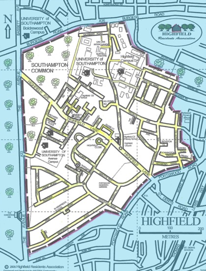
You will find details of the proposed ATZ which seems to focus on Highfield Lane, Brookvale Road, Russell Place and Abbotts Way.
In summary, there are to be new physical measures to deter any additional traffic in residential roads during the initial 6-month trial of the Bus-gate (7am-10am and 4pm-7pm). These include:
! A 20-mph zone for the whole area with Vehicle Activated Signage (p.3 of the report)
! A gateway (road narrowing on Highfield Lane outside Glebe Court) including new buildouts to slow traffic
! Buildouts with wooden planters on Belmont Road (north of Osborne Road south junction)
! 4 new traffic calming buildouts with one-way priority and cycle bypasses on Brookvale Road (1 between Portswood Road and Winn Road; 3 between Highfield Lane and the mini-roundabout at Blenheim Ave)
! A road narrowing and road filter notice (through-way for cycles or pedestrians only) at the junction of Russell place and Brookvale Road
! A trial traffic filter (to block cars) on Russell Place at its junction with Abbotts Way using planters and signage.
To support these measures, expect there to be many new road signs, new double yellow lines and the removal of some permit parking spaces in the ATZ area.
Although there is not yet a timetable for any works, it has been stated that the ATZ measures will be in place before the Bus-gate trial which is due to be operational by the end of January 2025. There may be residential traffic delays in the immediate months as advance construction begins.
The report adds that, ”The impact of all proposed measures under the Portswood Project cannot be fully known in advance, so delivering the scheme initially as a trial allows this to be tested. Depending on the results, measures could be removed, amended or added later.
The trial is to be evaluated by Key Performance Indicators where base data (currently being collected) will be measured against outcomes. HRA will circulate the details of these when they are available.
This is the link to the Officers’ Report
Annex A: Portswood Project Key Decision Points
Annex D: Method of Introduction of Proposals (draft)
This complex document lists on Page 1 all of the road changes that are planned, where they will be and reference to any legal framework.
Page 2. Is a table explaining the difference between a Traffic Regulation Order and an Experimental Traffic Regulation Order. The ETROs will come into force on Monday 27 January 2025. For these changes, residents will have six months to comment whilst the orders are in place.
Note – the Traffic Regulation Orders are out for public consultation from 25 October to 15 November. There is only a very short time in which to comment to the web address below:
https://transport.southampton.
There are only 2 Traffic Regulations open for consultation at this stage:
1. To introduce a Loading Bay for Goods Vehicles in St Denys Road (Spur) south side
2. To introduce a 20-mph limit on the following roads for their entire lengths unless stated otherwise:
Abbotts Way, Alma Road, Avenue Road, Belmont Road – between its junction with Lawn Road to its junction with St Denys Road, Blenheim Avenue, Brookvale Road, Cambridge Road – between its northern closed end to its junction with Lodge Road, Cedar Road – between its junction with Avenue Road to its junction with Lodge Road, Clifford Dibben Mews (off Avenue Road), Crofton Close, Earls Road – between its junction with Livingstone Road to its junction with Lodge Road, Gordon Avenue, Highcliff Avenue, Highfield Lane – between its junction with Glebe Court (eastern junction) and its junction with Portswood Road, Lawn Road, Leigh Road, Livingstone Road, Norcliffe Road, Oakmount Avenue, Osborne Road South, Portswood Avenue, Portswood Road – between its junction with Lodge Road to its junction with St Denys Road, Regent Court (off Winn Road), Rigby Road, Rose Road, Russell Place, Shakespeare Avenue, Spear Road – between its junction with Lodge Road to its junction with Avenue Road, Spring Crescent, St Denys Road (Spur), Tennyson Road, Thackeray Road, Westbourne Crescent, Westridge Road, Westwood Road, Winn Road, Woodside Road, and Woodstock Drive.
Annex C: An overview map of proposals for the Broadway and ATZ
This is one page and useful as an overview
Annex B: Portswood Steering Group – Log of Comments and Responses
This is a document listing comments made by members at the Steering Group Meeting 2 or submitted in writing in advance, mainly about the proposed ATZ measures and the SCC response to those points raised.
2. Imminent letter from Highways Service Partnership – Traffic Regulation Orders and more
HRA understands that some occupiers are shortly to receive a letter which provides an update on the implementation of the Broadway scheme and the ATZ. It also introduces the TRO/ETRO Consultation process. The letter will be distributed to all properties within the 20-mph zone. It will be important for HRA members to engage with the process of consultation.
If you do not receive a letter, you will be able to read about the Portswood TROs here:
https://transport.southampton.
You can make a comment online (address above) or in writing to the Highways Legal team at Southampton City Council, Civic Centre, Southampton SO14 7LY.
3. Scheme Information
General Scheme Documents are published in a different section of the SCC website
https://transport.southampton.
Buried within this different section of the SCC website are important pages of detailed maps and drawings of:
a. The Portswood Broadway Scheme Plan (bus stops, parking, signage etc)
c. The Portswood 20mph Scheme Documents
The scheme plans and all other documents can be viewed using the links above. Alternatively, hard copies can be viewed at:
- October Books,189 Portswood Road, Portswood, Southampton, SO17 2NF
- Portswood Library, Portswood Road, Portswood, Southampton, SO17 2NG
- Gateway in the Civic Centre, Southampton SO14 7LY

